离开布崃斯峡谷国家公园, 很快便到了景色绝佳的Zion 国家公园. 这Zion与加拿大的 Banff国家公园一起,被俺列为超一流的国家公园. 当然, 由于诸多原因的影响, 每个人都会有不同的感受. 其中的一个重要原因是天气。非常幸运的是, 俺的加拿大东部, 西部, 美国西部, 西南部,东部之行, 除在Jasper的头两天天气不太好外, 其余各天的大多数时侯都是蓝天白云. 另一个重要原因,则是很多人只是架/乘车匆匆扫视一圈,而忽略了那些徒步方能到达的美丽风光。
在中国时, 只听说过四个美国国家公园: 黄石, 大峡谷, 大沼泽地, 和约塞米特(Yosemite; 此乃以前国内摄影期刊的译法. 现今港人译成优胜美地(有什么的?), 俺觉得很俗气。 而且害得俺喝了很多瓶啤酒也没弄清这到底是哪儿; 俺一直以为那是夏威夷).
两年前, 还从未听说过Zion; 但出发前, Zion已成为此行的第一重点, 安排了三天.
出发前定计划时, 原准备造访Zion一天. 俺在俺的藏经阁中弄了一脸灰, 终于得出Zion一天已够的结论. 不料有高人声称最佳去处乃”Zion”, 并无任何解释. 俺心中一惊, 莫非经书有误? 赶紧放狗搜了一圈. 这一搜不得了, 看来这真经还真得烈火炼! 于是立即将其仍进火炉……
假如仅在Zion峡谷中花半天溜一圈就溜之大吉, 则将与70%的Zion景色失之交臂. 而且更遭的是, 由此留下不过如此的印象. 实际上, 要欣赏Zion的壮观景色, 必需去走那些 hiking trail: Angel’s Landing trail, West Rim trail, Observation point trail, The Narrow, and the Canyon Overlook trail,等等. 其中的Angel’s Landing trail更被誉为世上最佳之一.
天使降临处山路(Angel’s Landing trail)
此trail的头一部份与West Rim trail同路. 最后一段八百米长, 要从一形如鱼鳍的山脊上穿过, 两边皆是几百米高的陡峭的悬崖绝壁. 有多段非常危险, 靠铁链支持. 从起点算起, 此trail来回共8.6公里, 升高450米, 须时四小时. 公园告示”有恐高症者戒” (这不是说俺吗…). 俺们大约4:30PM 开使出发, 一路不见一个同路者, 仅遇到几个回程者. 在一峡谷深处, 光线已很暗. 暗地里担心回来时将更黑. 在那个著名的爬上山脊的21道拐(21 Switch-backs)处, 忽闻上面鸟语莺歌, 俺大喜, 这下人多不怕了! 上去一看, 原来是一大群来自纽约的女高中生. 当下审问出她们也是去Angel’s Landing. 这下可好了, 在山顶正好把这群angel弄进照片! Angel们人手一只KORDA 一次性像机. 有一位居然能说出俺的武器牌子型号; 俺大惊. Angel透露, 她老爸也有一只.
趁众人在Angel’s Landing trail与 West Rim trail的分叉处休息之际, 俺继续沿West Rim trail前进了几百米. 见天色不早, 返回望Angel’s Landing trail而去.
很快赶上大部队. 只见LP大人脚下排了一长队的KORDA 一次性像机, 正在为手拉铁链的angel们留下到此一游的证明. 此时西边山峰已处于阴影下. 为了抢在东边山峰也变阴前爬到顶, 俺一人先行前进.
未几, 到一两边皆是悬崖的极危险处. 此处长十余米, trail宽约两尺. 俺正努力思索不过去的理由, 忽见对面一个约八岁的男孩带领一个更小的男孩极清松的穿了过来. 俺问他上边是不是还有更吓人之处, 这小子答非所问, 只说他弟弟上山时也怕, 下来时则一点也不怕了. 言下之意…… 看来, 本大人还非得摸过去了!
这八百米路俺折腾了近四十分钟才爬完…不好意思.
过了很久, LP大人与千金驾到. 但angel们却仍不见踪影. 询问小千金才弄清原来angel们见路途险恶, 个个脸色发白, 眼睛发绿 (其实那是人家本来的颜色), 全部打了退堂鼓, 席数逃去无踪也. LP大人却说, 这与华山比起来, 危险程度差远了. 俺闻言大惊, 暗想俺当年决定不去爬华山是多么的英明, 正确, 对了, 再加上伟大啊!
这Angel’s Landing trail应明确标明为14+. 有几个路段是一失足成千古恨, 不会有犯第二次错的机会. 俺让小千金上去(她吓个半死)是个愚蠢透顶的决定. 不过, 正如那男孩所说, 下山时一点也不怕了.
1. The Great White Throne as seen from the beginning of the West Rim trail: 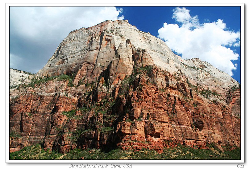
2. West Rim trail: 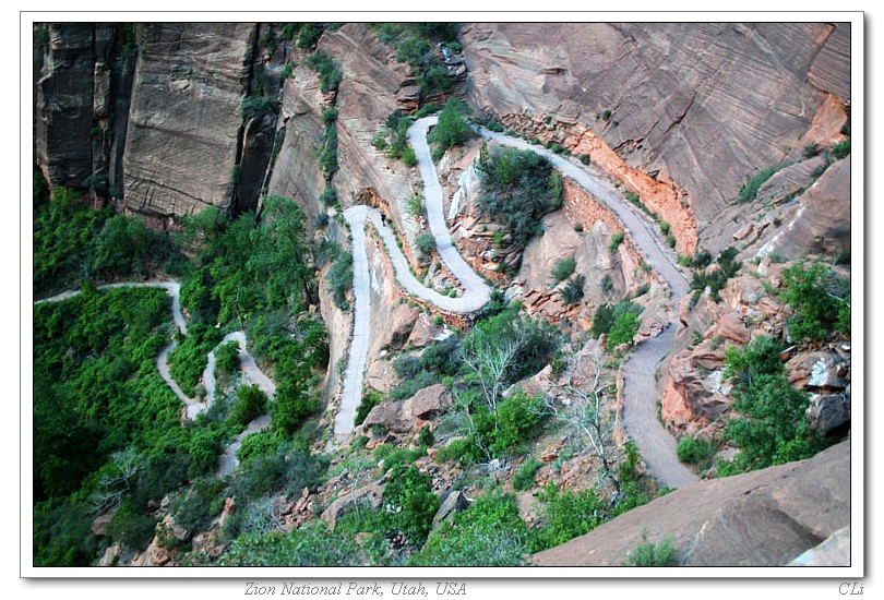
3. West Rim trail: 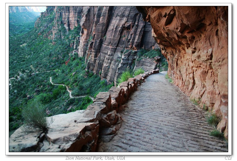
4.West Rim trail; In the canyon: 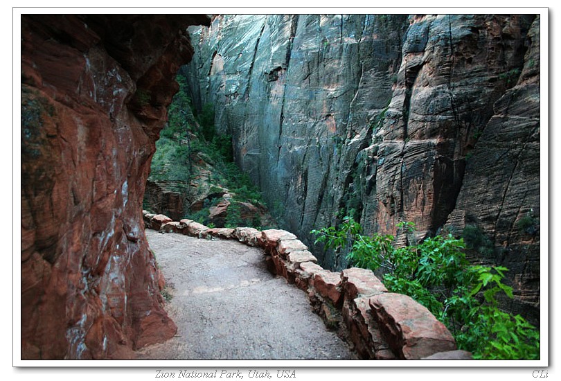
5. Climb up: 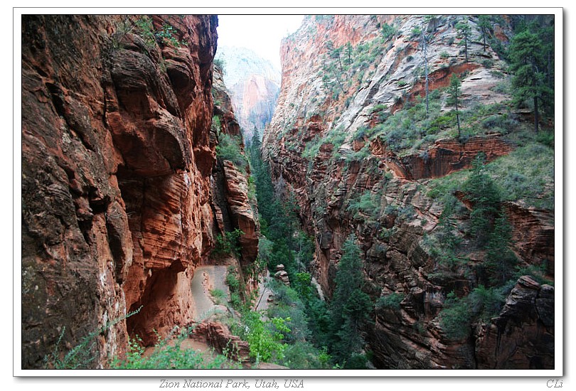
6.At the 21 Switch-backs that climb up the sheer rock: 
7.The 800 meters long Angel’s Landing trail as seen from the Observation Point. The trail goes from the right most side of this fin-rock, climb all the way to the top of it: 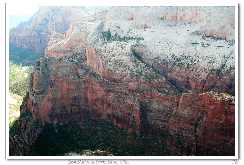
8.The beginning (easy) section of the trail: 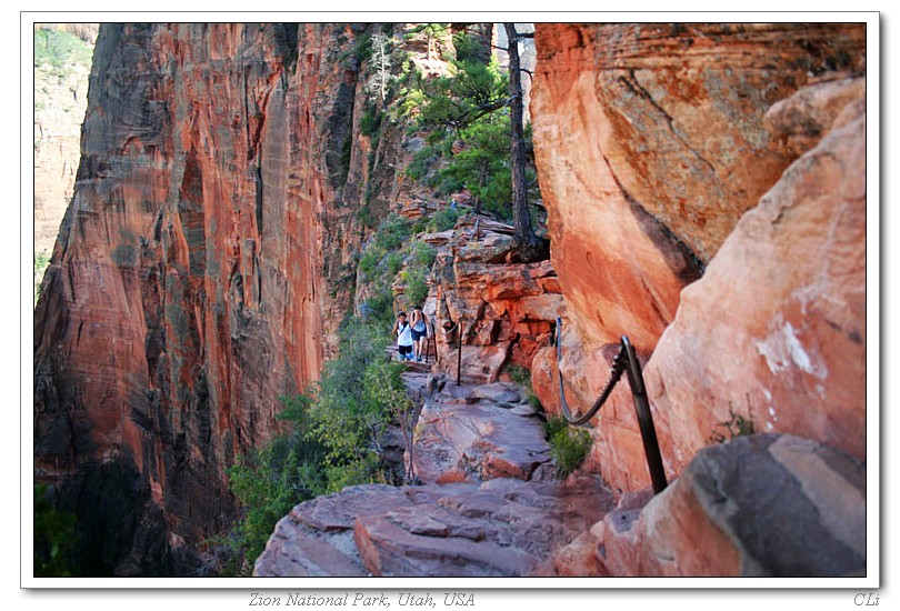
9. The Angel’s Landing trail; half way to go (need to climb to the top): 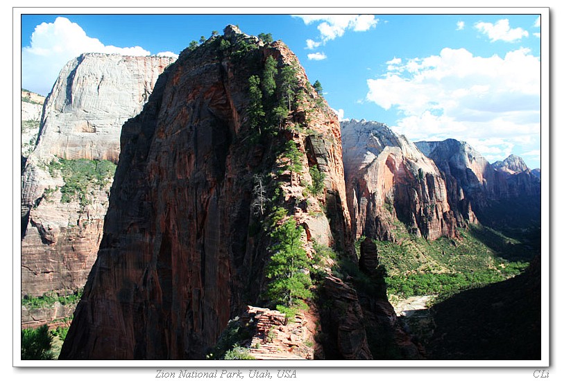
10.The Angel’s Landing trail as seen from the top of itself; the trail start from the half way of this fin-rock where there’s a while toilet hut. West Rim trail continues up the other direction: 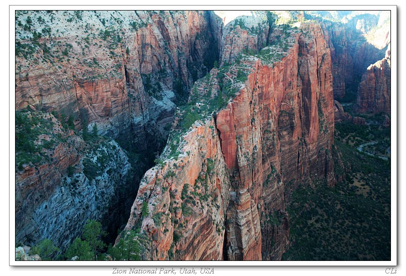
11.The Angel’s Landing trail as seen from the top of itself 2: 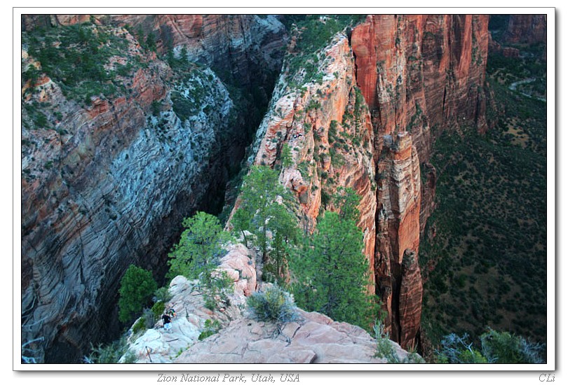
12.A spectacular view of the Zion valley as seen from the top of the Angel’s Landing trail: 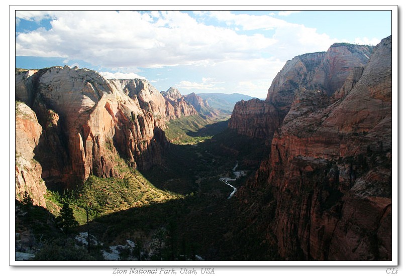
13. The top of the Angel’s Landing trail; 要是那群angel站在这里就好了: 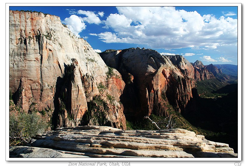
14.Observation Point (the highest point that is close to the left side of this pic) as seen from the top of the Angel’s Landing trail; we climbed up there the next day: 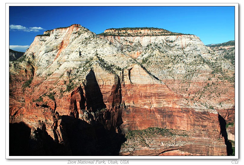
15.Looking down from the Angel’s Landing trail: 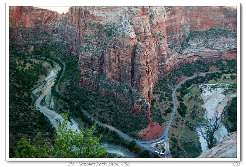
16.The Big Bend as seen from the Angel’s Landing trail: 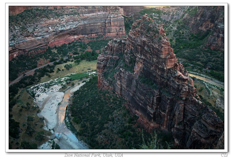
美西三周游 13: 最佳公园 - - 姿昂(Zion)国家公园 I
登录后才可评论.